
Today we left Kearney, NE for points east. The time zone changed to Central time about 100 miles west of where we stayed and caused confusion in the morning. We first ate a quick breakfast at Subway without great coffee. We then headed to the Kearney visitor center to pick up a booklet on the Lincoln Highway through Nebraska. I asked the young woman at the center what the sirens were that we heard the following evening. She informed me that that was a tornado warning. Interesting that no one at the motel expressed any concern or informed us of the issue.
We then went to a souvenier shop to pick up Lincoln Highway T-shirts. I asked the owner, a Nebraska native, what we should do if we encounter a tornado on the Nebraska flat lands. He said to drive the other way. Hummm...local knowledge was of little help to us.
Heading east out of Kearney, we first encountered the Morris Cookbook publishing company on Route 30. We stopped to see what they did and they had a package to assit you in publishing your own cookbook. Earline has been thinking of this for a long time and this might finally spur her onward. They had hundreds of cookbooks that are self-published for charitable events at reasonable costs.
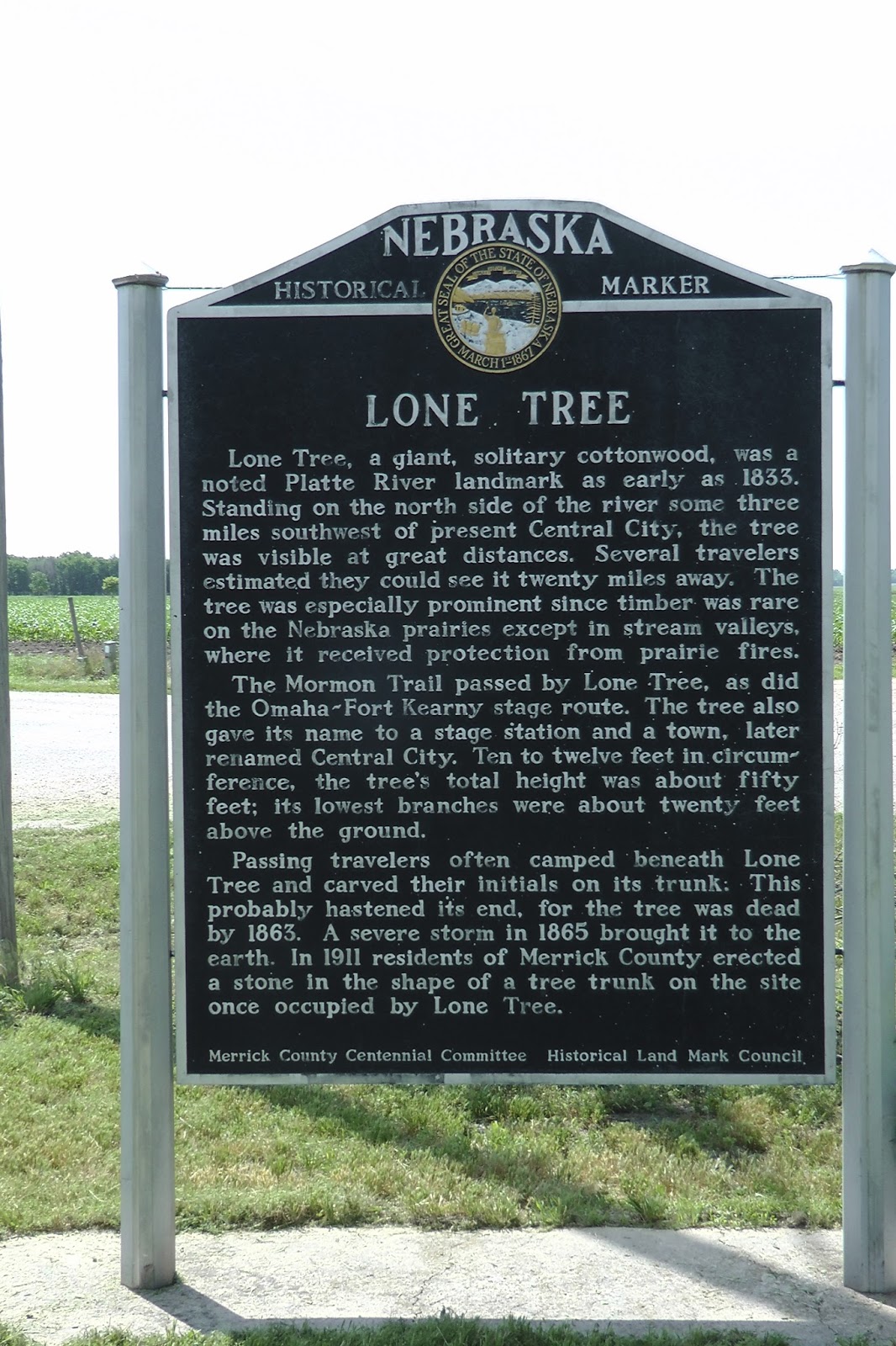
During our eastward travel, we stopped at historical markers along the roadway. One of these markers described a landmark called Lone Tree. This was a giant cottonwood tree, 20 feet in diameter that could be seen for 20 miles and was used by the early travelers of the California Trail or the Mormon Trail and others to guide their journey. Unfortunately, the tree blew down during a storm in 1865. The site was supposed to be marked by a concrete marker but we could not locate the marker.
Another interesting marker in Columbus, Nebraska, describes the North Brothers who were Indian fighters. You can read about them here.

We crossed the border to Iowa at the Missouri River. You couldn't help but wonder how the early pioneers got across that river with their wagons and horses. Here is some information on how the Mormons got to the crossing point. Times were tough in those days. When the Union Pacific Railroad got established, the trails became obsolete.
Upon crossing the Missouri River, we came into Iowa and the visitor center is about 14 miles to the east. We stopped there and watched a movie on the Loess Hills of Iowa and a short film on the history of the Lincoln Highway. Both were very informative.
These hills were forms from the glaciers grinding rocks onto dust that then piled up as the wind blew. They are only found in this narrow band of Iowa and in China.
The visitor center had an original Lincoln Highway marker and an example of the Lincoln Highway going from dirt to gravel to cement.

Dirt to Gravel to Cement

Loess Hills in Iowa

Historical Museum at Welcome Center

Original Lincoln Highway Marker


Passing through Iowa brings a different perspective from the flat lands of Nebraska. There are still many cornfields but the land begins to roll gently and trees are more abundant. Several towns are larger than many with only 300 to 400 at the site of grain silos next to the railroad.
Eventually, we came to Ames, IA that has the University of Iowa in its midst. We decided we travelled far enough and stopped for the night at the Economy 8 motel for $60 for a king suite after senior discount. Dinner was taken at a local brewery called Olde Main Brewing Company and Restaurant. The beer and food was only mediocre.
Following dinner and failing to find any tango on a Monday night, we returned to our motel to get some rest.
No comments:
Post a Comment