Friday, June 14, 2013

Friday 6/14/13 Day #4 - Midvale, UT to Ely, NV Back to Evanston, WY

6/14/13 - Friday Day #4

Today was filled with driving all the way back to Ely, NV to retrieve my briefcase, minus my iPAD and $400 in cash. I picked it up at the Sheriff's office in Ely and filled out a statement for the police. Since the iPAD is unlikely to be recovered, and since it was never on line for me to track it, I locked the unit and erased it via the internet. Unfortunately the erasure assures that you cannot track it. Still, I feel better that the data is removed.

I went to the motel where I stayed and spoke with the manager. I did speak with the person thought to be guilty and offered to drop felony charges if the iPAD would be returned. I met with her and I explained the situation to her but she denied being guilty. She appeared to be lying and I explained that if she were to use the device, it would be tracked to her and she would have a felony arrest. Since she still denied having it, we left after erasing the data.

We drove back up the Lincoln Highway (Route 93 out of Ely) to West Wendover, NV. This is a place with a lot of gambling casinos but is of historical interest because it is the site of the Victory trail where emigrants came across to the west and is also the site of the Lincoln Highway.


Wendover Will

Marker for the California Trail at Wendover, NV


Important trails westward converged at West Wendover, NV


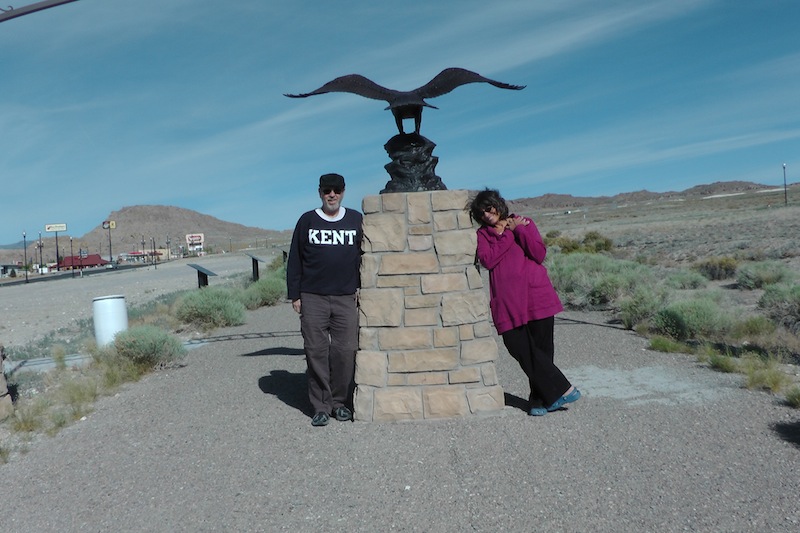
Lee & Earline on a portion of the original Lincoln Highway
West Wendover, NV


Bonneville Lake and the Origin of the Salt Flats


We took a picture of a portion of the original highway, ate lunch and headed east across the Bonneville Salt flats up Interstate 80 to stop in Evanston, Wyoming. All along Interstate 80 you can see portions of the Lincoln Highway paralleling the interstate system.

Evanston is where Interstate 80 meets Route 89, a highway running from the Canadian border to the Mexican border. We traveled this highway last summer and we stayed in Evanston and first saw a Lincoln Highway marker in the downtown historical district. Prior to this, we were unaware of the Lincoln Highway.


One of the original motor courts on the Lincoln Highway in Evanstan, WY. They are in the proscess of being restored for historical purposes.

A quick dinner at Sudworks Brewery and we headed back to our Econolodge that is located right on the Lincoln Highway. The room is adequate and not too expensive. Directly across from the lodge is River Walk, a nice stroll along a creekside park.


Tomorrow we hope to explore Laramie and Cheyenne, Wyoming to get a flavor of the west. :)

Thursday, June 13, 2013

Day #3 Thursday, 6/13/13 Ely, NV to Midvale, UT

This third day started out rather uneventfully after a rough evening of sleep at the White Pine Motel in Ely, NV. It was an adequate bed but the air conditioner noises from adjacent rooms was quite annoying. We rushed out of the room at 7:30 am to get a quick breakfast before heading east on Route 50. This rushing would later prove to be a rather bad thing.

First, I left my Samsonite briefcase with cash and my iPad at the side of the bed. This would not be discovered missing until we started to bring luggage in from the car in Midvale, Utah this evening. The case has been found but the cash and iPad are missing. The police are still working on the case and I will have to backtrack 300 miles tomorrow to retrieve the case and remaining contents.

The next rushing error was to continue on Route 50 rather than go to the north from Ely to The Great Salt Lake. This was not a bad error as it took us to Great Basin National Park and it was a great way to spend the day.


There is a great cave to explore at the park, called Lehman Cave. The human history of Lehman Caves is both interesting and insightful. The discovery of such a natural wonder only 130 years ago is thrilling, while the abuse the cave endured during its early years causes many people to cringe. Learning about the early years of Lehman Caves provides context for the cave today. History remains the great teacher.


People would snap off portions of the stalagtites as souveniers during the early years of the cave.

Shield formation

Bacon


After the cave exploration, we drove to the summit at 10,000 feet to look over the Great Basin. There is a Bristle Cone Pine Tree that lives there and it can live 6000 years.


Vistas from the summit


After leaving Great Basin National Park, we turned toward Utah to reacquire the Lincoln Highway. During this transit up Route 6 near Eureka, NV., we found this shoe tree. The original shoe tree described in the Lincoln Highway book was cut down by vandals. This is a different tree.


We arrived in Midvale, Utah at approximately 6:30 PM (after a time change to Mountain Time). This was when I discovered the missing briefcase. 

Wednesday, June 12 Lake Tahoe to Route 50 East

We left Lake Tahoe at 7:30 am and headed to Carson City, NV. Carson City is the state capitol of Nevada and we stopped at the visitor center to obtain a Route 50 survival guide. If you stop at 5 of 8 places on Route 50 (Carson City to Ely), they will give you a certificate to prove that you traveled the loneliest highway in the USA. It is a good marketing ploy for sparsely populated towns bypassed by Interstate 80.


While in Carson City, we took time to tour the state capitol building that was built for a cost of $164,000 in 1871. Furnishings cost an additional $20,000. The building was deemed unsafe in 1974 and was condemned for destruction. However, the legislature wanted to save the historic building and retrofitted it with a new concrete shell with the interior of the building bonded to the shell. They reinstalled much of the original interior at a cost of $6 million and saved the structure. There is beautiful Alaskan marble flooring and marble wainscoting, as well as black walnut railings leading to the second floor where a small museum is present. Oak adorning the sides of the stairs is faux painted. It had me fooled.

Carson City, NV Visitor Center
Alaskan Marble
Arsenic Ore - just in case you need some.

Highway sign in the small museum


 After touring the capitol, we walked a portion of the historic district of old homes following a "blue line" painted on the pavement starting at the old mint building. We did not tour the mint at this time as I have visited this in the past. We did see some beautifully preserved buildings that included the Governor's Mansion and the Krebs-Peterson mansion where John Wayne's last picture, The Shootist, was shot.


Highway marker next to the Carson City Mint


The Historic Governor's Mansion

Krebs-Peterson Mansion 1914
It was used for John Wayne's last movie, The Shootist.

We then proceeded to Fallon, the site of the Top Gun flight school.


Leaving Fallon, if you travel 8 miles to the east, you can find Grimes Point Archeological Area that has fine examples of 6000 year old petroglyphs. There is no entrance fee and it is a short loop walk.


Wednesday, June 12, 2013

Tuesday, June 11 - Day #1

Well we finally began the journey across the Lincoln Highway, leaving our Santa Cruz house at 9:15 am in the hands of Melissa and Dave, our house sitters. The pets have been left behind with sad looks, but they have a new family to adjust to as Melissa has two older dogs. Daisy, our Dalmation, is receiving extra attention from Duke, a white lab with testicles. I couldn't tell if she was happy or not but she was adjusting. Our two cats are busy writing in their "sad cat diaries" and are no doubt plotting revenge against Earline and me.    Sad Cat

We drove through Tracy and exited Route 5 at Harlin Road at the site of the Ghiardelli Chocolate building. We had always seen that building and decided to check it out. It is a factory outlet and they sell chocolate at about 50% off regular prices. In addition, they sell ice cream and coffee. We had a small dish of ice cream and a cup of horrible coffee. Do not buy their coffee despite their offers of giving a free cup if you buy a chocolate scone. Besides, they were out of scones and we foolishly purchased coffee anyway. They should stick to selling chocolate and leave the coffee to Starbucks. :)

It turned out the Harlin Road is the site of the old Lincoln Highway and we drove backwards to Lathrop where a Lincoln Highway marker was recently placed to mark the site of Wiggins Trading Post.


http://lincolnhighwaynews.wordpress.com/2008/01/09/marker-for-wiggins-trading-post-in-lathrop-pt-1/

Following a quick photo to document our marker find, we proceeded through Stockton following Pacific Highway through the town.  Pacific merges to become Lincoln Way and finally joins Route 99 northward to Elk Grove. We attempted to find a marker in Stockton, but were unsuccessful.

After a quick stop in Sacramento to leave some money for Sean, Earline's oldest son, for school books and a second quick stop to pick up some smoked salmon from Denise and Paul, our wonderful friends, we headed east on Route 50 towards South Lake Tahoe.

Just as we arrived in Sacramento, the "Service Engine Soon" light illuminated and a quick read of the owners manual for my Nissan Armada told me this was an emission problem often caused by a loose gas cap. Since I had recently changed the factory cap to a locking cap after someone stole all my gasoline from the vehicle while parked at the airport, I decided to replace it with the factory cap. Still the light remained on, causing some concern, especially as tomorrow we are to travel the loneliest road in the USA, Route 50 across Nevada. We called a Nissan dealer in Shingle Springs and the code reader cleared the code and he assured me that it was OK to drive the vehicle. The light has remained off.

We proceded through Placerville and located a marker in front of Tortilla Flats where a quick photo documented the find. After that we drove to South Lake Tahoe, across the state line and then on to Incline Village in Lake Tahoe to spend the night with Josh and Carol Bardin, good friends from my surgical residency days at UCSD.

Placerville, CA


Entering South Lake Tahoe
Josh and Carol Bardin

Monday, June 3, 2013

Livermore to Stockton

5/31/13  Friday

We still have not started the formal transcontinental journey on the Lincoln Highway, but because we needed to travel from Santa Cruz to Sacramento for a wedding, we decided to search out some of the more complex routing of the Lincoln Highway through Livermore, CA to Stockton, CA. The original route has been incorporated into more modern roads and in places, new development has made the highway unavailable. Still we wanted to try.

Prior to traveling this portion, we did find the Lincoln Highway in Livermore, CA. It comes down East Airway Blvd. that then becomes Portola Avenue. If you follow this, you come to N. 1st Street where you make a turn to the right for one block and then make a left on Pine Street. This takes you to Portola Park. Just as you turn, you find and old garage at the corner of 1st and L Streets called the Duarte Garage.

The Duarte Garage was built in 1915 by F.H. Duarte on the original Lincoln Highway, the first transcontinental U.S. Highway.  When the Carquinez Bridge was opened in 1927, the highway was re-routed and this section was eventually renamed Portola Avenue.

The garage sold Associated gasoline and oil products and also performed repairs.  In 1923 the south half of the garage was added and became an automobile dealership, selling Durant Star and Flint models.  Robert Livermore Jr. was one of the salesmen in the early 1920’s.
      
In the early 1940’s the garage was converted into a machine shop for rebuilding winery and farm equipment.  During the 1970’s the City of Livermore purchased the Duarte Garage and surrounding land for use as a park.  The Livermore Heritage Guild signed a lease in 1976 to restore and maintain the garage for use as a museum.

Duarte Garage, Livermore


In the Portola Park next to the garage, you can find a Lincoln Highway sign.

If you follow Portola to Fiorst Street and make a left turn, you will joint up with Interstate 580 where you travel towards Tracy. You exit the interstate at Southfront Rd and turn left on Greenville Rd. to reach the Altemont Pass Road. This road is the route of the original Lincoln Highway and parallels the interstate highway. It goes through the golden hills and weaves near the wind farms. Just after Altemont Pass Rd. joins with W. Grantline Rd., to come to a historical place called The Mountain House. The Lincoln Highway (LH) then travelled through the town of Tracy as detailed in this newspaper article.


There are now some detours created in Tracy via new development that made us have to return to Interstate 5 towards Stockton where we exited at Frenchcamp. We ended up missing the original route that goes northward on Pacific Avenue in Stockton. Instead, we we on Route 4 east until we hit Route 99 and traveled north. It eventually merged with the LH just south of Galt. When we leave Santa Cruz on June 11, approximately, we plan to attempt to find the old route through Stockton before reaching Route 50 that will take us around south Lake Tahoe. I think it will be easier to follow the Lincoln Highway after we get out of the larger cities.